|
| |
Bryophyte Sampling Field Procedures |

|
 |
Three transect lines, each 50 meters in length, were set up in three areas of forest near the Bamfield Marine Research Station. The exact location
of the line was chosen randomly, with only the requirement that the entirety of the line fall within a relatively homogenous area (i.e., a single plant
community type). This map shows an aerial view of the study area. At each transect (1,
2, & 3), the following survey procedures
were used:
|
- Upon selection of a starting point for the transect line, a measuring tape was extended for 50 meters and a permanent iron rebar
marker was installed at both the start and end points. The geographic coordinates of both the start and end points were recorded and
marked in a Global Positioning Systems (GPS) unit. The slope, aspect and compass bearing of the transect line were also recorded.
|
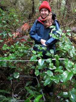
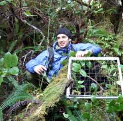
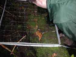
- At each transect, 16 quadrats (0.5 m x 0.5 m or 0.25 m2) were randomly placed on alternate sides of the transect with the corner of the aluminum
grid starting from the random number selected for that quadrat and covering the next 50 cm of the tape. In each quadrat, we identified the species
present and estimated its abundance by counting the number of squares (out of 100) in which the species was present.
|
- Unknown bryophyte species were collected for later identification. Samples were collected from outside the plot area to avoid affecting the present
and future abundance of that species within the plot.
|
- For each species in the plot, we also collected information about the presence/absence of sporophytes and the substrate upon which the specimen
was growing (e.g., mineral soil, decaying wood, bedrock, etc.).
|
- For each of the 16 plots, the following information was recorded:
- surface topography (the presence and frequency of microtopographic features such as hummocks and hollows)
- canopy cover class (<5%, 5-25%, 25-50%, 50-75%, 75-95%, or >95%)
- litter type (needle persistent, needle decaying, deciduous, or herbaceous)
- lichen types and percent cover
- general habitat description and diagram of plot
|
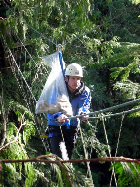
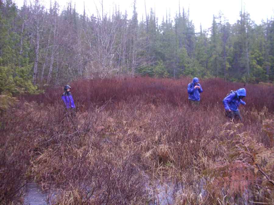
 In addition to the three formal surveys along transect lines, we also sampled bryophyte diversity randomly in three different habitat types:
forest canopy, seashore, and bog. For these sampling
procedures, no permanent plots were created. Samples were collected with the intention of identifying as many species as possible in each habitat type,
and will contribute to the overall list of species found within the Bamfield Reserve. Click here for the results... In addition to the three formal surveys along transect lines, we also sampled bryophyte diversity randomly in three different habitat types:
forest canopy, seashore, and bog. For these sampling
procedures, no permanent plots were created. Samples were collected with the intention of identifying as many species as possible in each habitat type,
and will contribute to the overall list of species found within the Bamfield Reserve. Click here for the results...
Methods were adapted by Scott Black from the Field
Manual for Describing Terrestrial Ecosystems,
Land Management Handbook Number 25,
BC Ministry of Environment,
Ministry of Forestry. 1998.
|